I wrote last summer about my visit to my old favorite honey hole on the Gardner river in Montana, and this year I decided to hike into the park from the North Gate in the Town of Gardiner. The old road through the park from Gardiner to Mammoth Village was destroyed by the flood of 2022, and the new road is way up on the hill above the river. The Old Stagecoach dirt road was quickly paved and is now a beautiful piece of asphalt.
Google has yet to update their maps with current imagery, still showing an intact road surface from the bottom to the top. Microsoft’s Bing maps does show the current condition, along with other substantial changes the the Gardiner area. A fire in July of 2020 destroyed a few buildings on the north edge of town, some of which have been replaced with temporary tent structures and one or two with new construction. When I asked at Park’s Fly Shop in town where the best place to park was (haha), they suggested the area next to the RV parking lot right next to an empty plot, where one of the burnt buildings has yet to be replaced. Google does have the street view of that…
I had only fished the lower section of this river once or twice before, in the pre-flood era, parking at a turnout and boulder-hopping upstream. In my recollection, it is a steep gradient river through this stretch, very much pocket water with large boulders and staircase pools dropping one level to the next.
This time, however, I was not able to get that far upstream to find out. There were two washouts that were passable by hiking around them, but at the third one, there was no safe passage, as the road had disappeared next to a steep hill face with soft dirt. A long fall to hard rock if you happened to slip, and in fact there was evidence of that danger, clear as day. The bleached white bones of a large animal lay next to the concrete manhole structure that at one time provided access to the pipes under the road.

I suppose that if you were so inclined, you could hike a wider path around the washout, possibly going far up the hill on the western bank from the previous washout. There was no easily wadeable path across the river close to the washout at the bridge.
Bing Maps says it is 1.6 miles from the Yellowstone Park sign at the edge of town to this dead end up the road. There are good stretches of fishy looking water all of the way, though I did not have a single hookup on the way up or back. I tried a number of hopper/dropper combinations, and I had a couple of small fish take a swing at the hopper, but they missed.

Farther up the road there were some deep slots next to a steep rock face that surely held some larger fish, but I wasn’t able to get a decent drift through the turbulent current seams. I tried with a bobber and deep nymph setup with similar results.

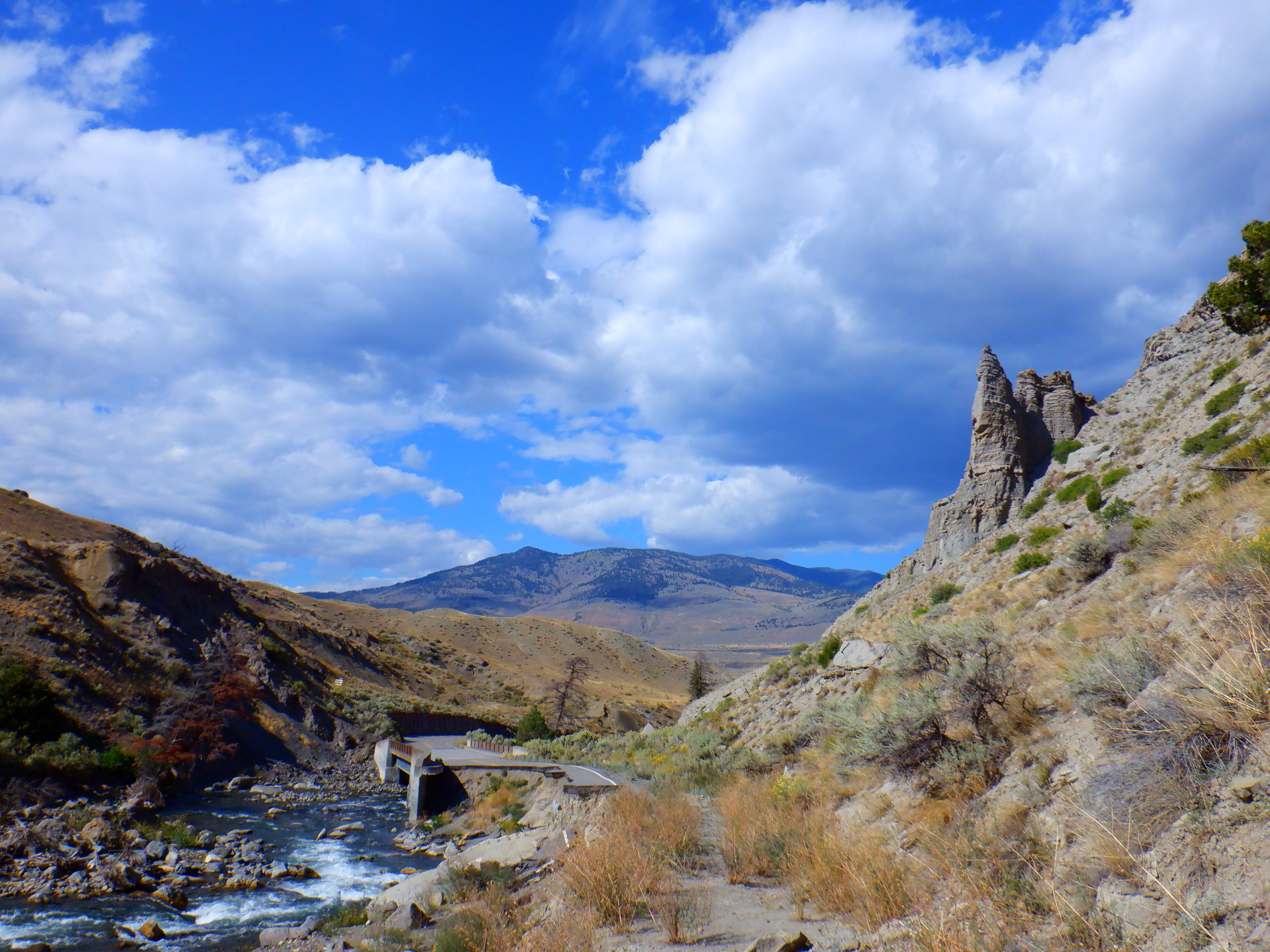
From the parking area at the bottom, it is a short walk to where the new road splits west, just after the entry gate. The river is a ways down hill from the old road, but there is a path that will take you to the water. I didn’t go straight down, because there was a small herd of elk enjoying the river when I arrived. Better to walk further up the road before getting down to the water.

I followed the river a short way upstream to the old Rescue Creek bridge, which was destroyed in the flood. Just around the corner from the trailhead parking area is the first washout, and the first sign I encountered.

The first washout was easily walked around up the right side, though you could also walk down and hop through the rocks below.

The second washout was much more dramatic, and required a wider detour up the hill above, with a slightly slippery descent on the other side, past the steel structure holding back the hillside.

Just beyond this washout was the first road bridge over the river, which somehow held up against the floodwaters. It is hard to imagine the scene at the time that this road was being destroyed. Harder still to imagine how any fish could find refuge in slow water to survive such a cataclysmic event.

In another kind of interesting tech giant competition, the difference between Google and Microsoft really shows up here. Google’s satellite view shows the old road as intact and the new road as dirt, but they show the street view on the new road. Bing shows the old road as destroyed, but still has their street view on the old road. Here’s my view of the washout from the bridge…

And here is Bing’s street view of how it looked prior to the flood…

And here is Google’s street view from the new road above the river…
This is where I was forced to turn back. Though there were some fishy looking slots in the water below the bridge, there was no easy path down to the water, and though I could have easily scrambled down, I’m not sure I could have found hand holds to get back up.

And how about some praise for the engineers that designed that bridge! The upstream-facing concrete abutment remains intact, and somehow diverted the energy of the deluge to save the whole structure. Surely the flood was raging over the top of the bridge, and both steel railings remain undamaged.
On the way out, I had a second encounter with the elk herd that was in the river as I began my day. As I approached the bend that they had been in earlier, my phone rang and I sat down on a rock to talk with my friend. The females were scattered on the rise above the water, and the bull elk was directly across the river from me, none too distant, but safe enough, with the river and two embankments between us. I made a joke to my friend about the immature status of this bull, only a two pointer, four tops, with his meager rack still appearing red with velvet.
As we talked, the bull moseyed to my right and eventually out of sight. “It’s fine”, I thought, “he’s on the other bank with his harem.” I continued to chat on the phone.
The next time I looked to my right, the elk had crossed the river and come up the bank, and was staring at me from 25 or so feet away! Yikes! I quickly stood up and gathered my gear, backing away in what I’m sure must have looked like great panic. I almost tripped and fell as I stumbled over a rock. Fortunately, the bull was merely amused, and he made his way back down to the water.
I wish I’d taken a picture of my close encounter, but then I’d just as likely been the fool to get trampled or gored to death, within spitting distance of the park gates! Ha.

In the end, it was a short hike with lots of interesting stuff to see. I was a little bummed to not have seen any fish, but how many fish does a guy really need to catch in such spectacular scenery? I think I’ll be OK.
Leave a Reply